A free app for smartphones that displays traffic and broadcasts your own aircraft’s position has been launched across Europe.
Called SafeSky, the app anonymously shares your position in flight while receiving the position of other pilots, using in-flight mobile internet.
It’s been created by a Belgian startup founded by six pilots and has been in operation in Belgium and France since the end of March. It was rolled out for the rest of Europe last Friday, the 14th.
“More than 10,000 Belgian and French pilots of all types of aircraft have adopted SafeSky,” said the company. “SafeSky’s mission is to make the sky the safest place on earth. Today [launch day] the skies will become safer, a leap forward for the safety of all air users.
“SafeSky is simple in use and user-friendly: it relies on the in-flight mobile internet network. Intensive testing on all types of aircraft has shown a very high coverage efficiency (average above 90%) in all kinds of environments, lowlands and mountains, as well as an extremely low data consumption.”
SafeSky Video
The app has the backing of EASA. Dominique Roland, Head of Policy and GA Champion at EASA, said, “EASA is promoting the use of iConspicuity devices, and is welcoming the proposal of SafeSky. We hope that this kind of initiative will contribute to raise the awareness of General Aviation airspace users concerning the risk of mid-air collision”.
SafeSky says there are three key elements:
1 Free of charge The more SafeSky users there will be, the safer the sky will be! In order to quickly gather a large number of users and create a genuine community focused on flight safety, SafeSky is free of charge.
2 Interoperability SafeSky aggregates ADS-B, FLARM and OGN traffic. This traffic is added to the native positions of SafeSky users. The addition of all these data provides the most complete traffic information system on the market today.
SafeSky will be compatible with other existing services, as well as navigation software, offering as such complementarity and safety for all.
SafeSky has created strong partnerships with OGN, to share traffic information and to develop future joint projects. Other discussions are also happening including investigating interoperability with drones.
3 Anonymity A pilot’s first and foremost interest goes to the position of the person flying in front of him, not his name nor his registration number. That’s why SafeSky transmits by default the positions in a totally anonymous way, respecting the privacy of all.
SafeSky can be downloaded for free from the App Store or on Google Play.
An ‘Early Bird’ version with additional features is available now for €24.99 per year. Both versions offer the same level of security, transmission and reception of data in flight. “We aim for security first, and for everyone,” said SafeSky. “The main difference lies in the management of fellow pilots and the set-up of squadrons.”
SafeSky
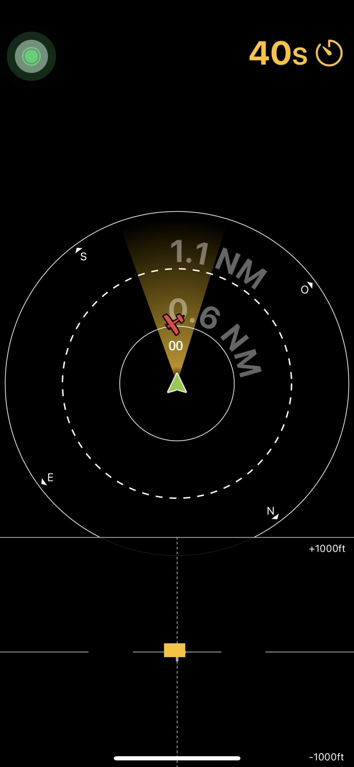
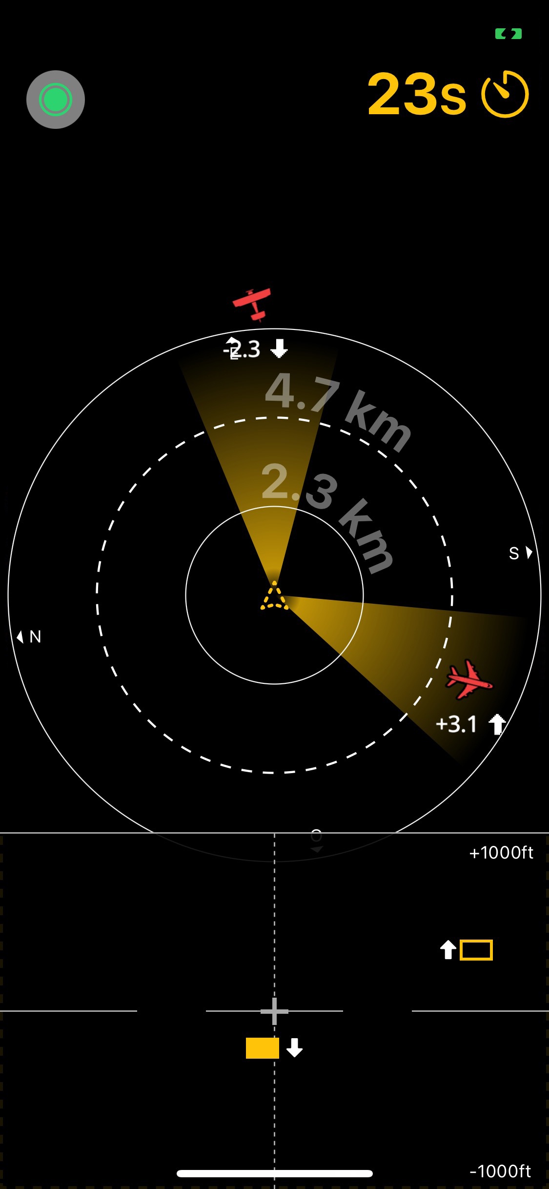
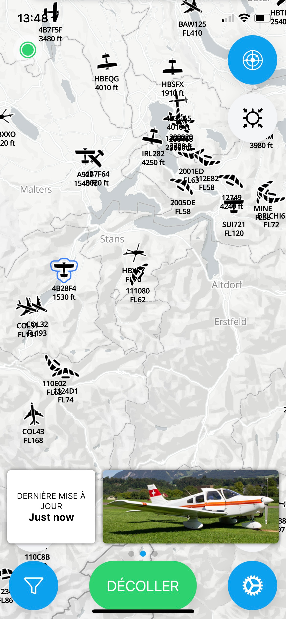
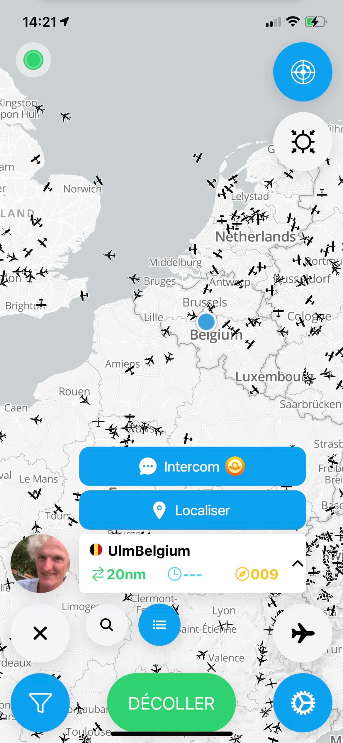
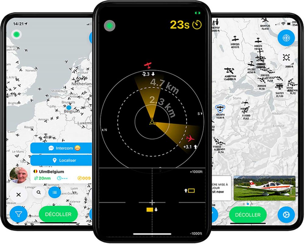
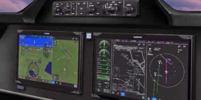
SafeSky Screenshots

13 comments
Is this legal under the mobile service contract? Has Flyer had any contact with OFCOM ?
What could possibly be illegal about using GPS & mobile broadband, whether sitting on a 1500 foot high hill or flying at 1500 feet in an light aircraft?
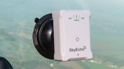
When was the last time you had reliable mobile coverage whilst flying in a mini-faraday cage at 3000ft? Please can we stop re-inventing the wheel and standardise on a system that is known to work reasonably well: ADSB in & out.
I get good mobile coverage all of the time.
When you fly paraglider, ultralight or balloon, you are not in a Faraday-cage and your position might be of interest for other users of the sky. And as long as ADSB in&out will not fit into a paraglider-pilot’s pocket, this is not going to change…
According to this post, SafeSky seems to have pretty decent network results:
https://www.safesky.app/en/news/one-month-later-id35
Does it work in Latin America and the US?
Not yet… Maybe end of this year
WI’ll it work with xcSoar or skydemon?
Yes. it does already.
I can find any mention of position unreliability due to latency of transmissions mentioned on their website.
Any system which depends on cellular coverage and remote data concentrators ( the data centres which integrate the reports then re broadcast) cannot give an assurance that it will work all the time, nor that there will not be variable latency, ie delays, so position reporting is slow. Some cell phonevsystems get confused if a user reaches mutiple cells, as often happens from aircraft. Its a variation on pilot aware without the dedicated hardware, but with the same operational limitations. It will work some of the time, maybe even most of the time for many, but the implementation cannot give me the coverage assurance that an ADSB system provides… Air to Air, no latency, no need for remote servers or cellphone coverage. I have downloaded this app and am trying it. I fly over mountainous areas, and will report on what i see on this vs my ADSB system
latency of transmissions .. not an issue when your dealing with the distance of separation and speeds remember you are not going to start in a position of danger your going so even a 10 second latency should not put you into a position of danger you should not already be aware of.