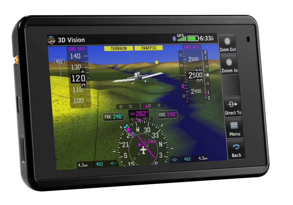
“The most powerful, robust and capable handheld device of this size ever designed,” is the bold claim Garmin is making for its just-released aera 660 portable GPS unit. As with other recently launched Garmin devices, the aera 660 has built-in wireless connectivity which enables it to communicate with other in-cockpit avionics and equipment.
The aera 660 will go on sale later this month at a recommended price of $849 (about £610). It has a 5-inch screen which can be viewed in either landscape or portrait mode. It uses Bluetooth to link to devices such as an ADS-B transponder to display traffic and weather information.
“Pilots have been asking for a new, purpose-built, easy to use aviation portable from Garmin and we have answered with the most powerful, robust and capable handheld device of this size ever designed, the aera 660,” said Carl Wolf, Garmin’s vice president of aviation sales and marketing.
“For 25 years we have been the market leader in bringing innovative portable navigation devices to the cockpit that improve aviation safety and we have done that yet again with this terrific aera 660 – a premium portable product that conveniently fits on the yoke or in the palm of your hand.”
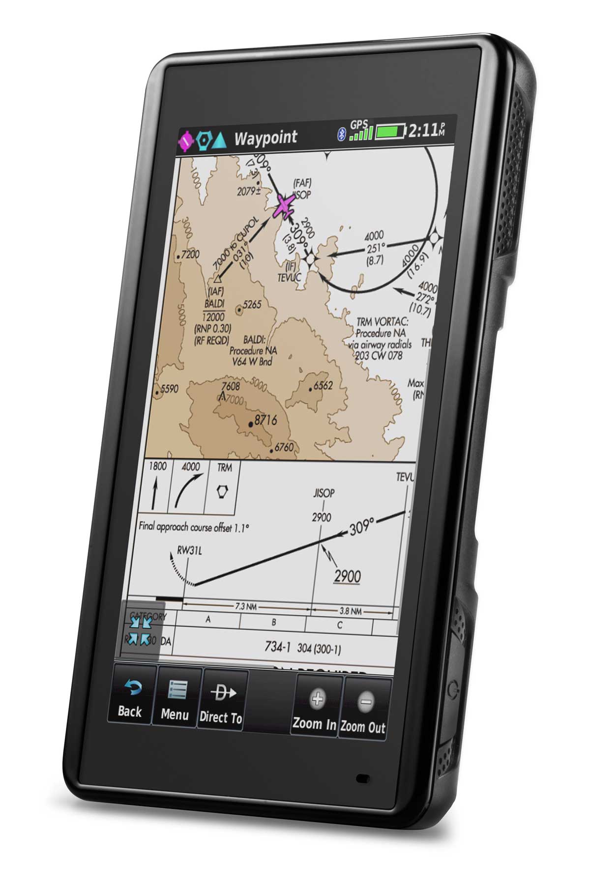
Garmin’s new portable, the aera 660, can be used in portrait mode, above, or landscape, top.
Key features
- 5-inch touchscreen display
- Meets temperature tests and helicopter vibration standards
- Direct-to navigation feature
- Up to four hours of battery life
- Synthetic 3D vision with attitude, airspeed, vertical speed indicators
- Lateral and vertical (VNAV) deviation bars
- 360-degree HSI
- Connext wireless connectivity
- Connects to Garmin VIRB XE HD action camera
- TargetTrend visualises the future position of nearby traffic
- TerminalTraffic detects and displays other aircraft or ground vehicles on runways or taxiways
- SafeTaxi geo-referenced airport diagrams
- Global chart options
- Geo-referenced IFR enroute, VFR sectional charts and Garmin FliteCharts terminal procedures
- ChartView enables the display of Jeppesen charts
- Smart Airspace highlights airspace nearest the aircraft’s current altitude and de-emphasizes non-pertinent airspace
- For Europe, the Atlantic version includes new Enhanced Basemap with more visual landmarks and intersections used when contacting air traffic control
- Street names populate when selecting a street or intersection on the moving map
- WireAware & VFR helicopter charts.
Garmin